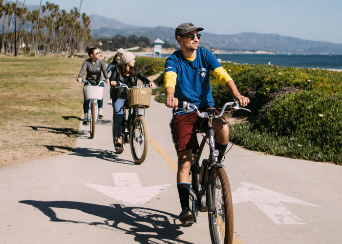
Santa Barbara Bike Paths For All Riders
Santa Barbara is a well-known destination for experienced mountain bikers and road cyclists looking to climb it’s dramatic peaks just a short distance from the Pacific Ocean. What is less known is that it is an excellent destination for families and casual bikers to cruise along the coast as well. The Santa Barbara bike paths highlighted below are all mostly flat, separated from vehicular traffic, and great for the whole family. We’ve also highlighted the Pacific Coast Bike Route for those looking to do a longer ride.
Cabrillo Bike Path
The Cabrillo Bike Path stretches from Leadbetter Beach just west of the Santa Barbara Harbor to Butterfly Beach in Montecito. This Santa Barbara bike path is easily accessed from Santa Barbara’s waterfront and downtown hotel locations, as well as from our storefront! The majority of this 4.5-mile path is free from vehicle traffic and designated for pedestrian and bike use only. The lack of vehicle traffic makes it a great option for the entire family. We recommend one of our seven-speed cruisers for this Santa Barbara bike path.
Points of Interest along Cabrillo Bike Path: Santa Barbara Bike Paths
Leadbetter Beach
At the far west end of this Santa Barbara bike path is Leadbetter Point and Beach, a popular beach for locals and visitors alike. It’s a broad crescent cove and sandy shores allow for ample room to spread out and enjoy beach activities. There are barbeque pits where the grass meets the beach in the lower lot available on a first-come, first-serve basis. Shoreline Cafe is at the entrance to the lot and is a great choice for a quick bite or refreshing beverage.
Santa Barbara Harbor and Breakwater
The Santa Barbara Harbor and Breakwater are located between Leadbetter Beach and Stearns Wharf. Here you’ll find one of the favorite local restaurants, the beloved Brophy Brothers. The breakwater extends around the entire southern edge of the harbor, protecting it from the waves and winter storms. There are plenty of bikes racks here to lock up at so you can hop off and explore the harbor area.
Stearns Wharf
At the base of State Street lies the historic Stearns Wharf. Since it’s completion in 1872, Stearns Wharf has been the centerpiece of the Santa Barbara waterfront. Home to shops, restaurants, a wine tasting room, and Sea Center, the wharf has something for everyone in the family. Riding bikes will allow you to avoid the long lines of vehicle traffic that occur on the wharf every summer. This is often the busiest portion of any of the Santa Barbara bike paths. As you head towards Leadbetter or East Beach from here the volume of bike and pedestrian traffic decreases significantly.
Funk Zone
A one-block detour from the Cabrillo bike path will plant you firmly in Santa Barbara’s Funk Zone. Santa Barbara’s Funk Zone is home to a plethora of eateries, breweries, wineries, and boutique stores. While the funk zone occupies a small area, the density of shops leaves much to be explored during your biking adventure!
East Beach & Andree Clark Bird Refuge
On the eastern edge of Santa Barbara and along the Cabrillo Bike Path you will find East Beach and the Andree Clark Bird Refuge. East beach is a popular spot for sunbathing and volleyball, with more than a dozen volleyball courts. Directly across from East Beach and along this Santa Barbara bike path is the Andree Clark Bird Refuge. There are three viewing platforms along the bike path that surrounds the bird refuge. Over 200 species of birds have been observed at the Bird Refuge. Native and non-native turtles can be observed basking on floating vegetation and along the perimeter of the islands. Sensitive wildlife resources present at the Bird Refuge include tidewater goby, southwest pond turtle, and several birds protected under the Migratory Bird Treaty Act.
Butterfly Beach
The Cabrillo Bike Path terminates at Butterfly Beach in Montecito. This beach offers excellent opportunities for sunbathing, swimming, and views of the Channel Islands. Additionally, it faces west, unlike most of Santa Barbara’s beaches which face south or southeast. This allows for great viewing of both sunrises and sunsets. Though the Cabrillo bike path ends here, there is a dedicated bike lane on Olive Mill Road that allows you to continue into the heart of Montecito along Coast Village Road. You also can connect to another Santa Barbara bike path from here, the Pacific Coast Bike Route.
Obern Trail and Maria Ygnacio Trail Bike Paths
Obern trail is a pedestrian and bike-only path that begins at Goleta Beach Park and travels 7.1 miles to its termination point at the Modoc Preserve. The path follows Atascadero Creek for large portions of the trail. Additionally, you’ll have the ability to head in the other direction from Goleta Beach Park and check out the UCSB campus on it’s dedicated bike paths. As a UCSB alumnus, I highly recommend exploring UCSB via bike path for prospective students. Because the bike path is surrounded by residential neighborhoods, you’ll often see families out on the weekend. If you’re looking for a bike path that has less traffic for the younger riders in your family, this is the choice!
Maria Ygnacio Trail branches off from the Obern Trail and heads north towards the Patterson Open Space. Like Obern Trail, it is for pedestrian and bike use only. The path winds between residential neighborhoods and open spaces and offers more shade than the waterfront Santa Barbara bike paths. Again, these two Santa Barbara bike paths are great for the family since you are away from motor vehicle traffic. We have kids bikes in multiple sizes, tag-a-longs, kids carts, and child seats that are perfect for this trail.
Points of Interest along Obern Trail and Maria Ygnacio Trail Bike Paths:
Goleta Beach Park
The 29 acre Goleta Beach Park has a large grassy area with picnic tables, a wide sandy beach for sunbathing and swimming, a fishing pier, and the Beachside Bar-Cafe, which serves up drinks and seafood right on the beach. There is ample free parking, and the park is open sunrise to sunset. This is a great location to start your Santa Barbara bike path adventure.
Campus Point and UCSB
Just up the hill and west of Goleta Beach Park is Campus Point and UCSB. UCSB has dedicated bike paths throughout campus free of motor vehicles. Touring the campus on a bicycle is a great way to see all the campus has to offer, not to mention providing prospective students an idea of how they will be transporting themselves to and from classes! Campus Point is a popular beach for sunbathers and surfers, and there are ample bicycle parking areas right near the beach. While not a designated Santa Barbara bike path, the paths that run through UCSB are great to explore.
Patterson Open Space
Also known as Patterson Neighborhood Open Space, this is an unfenced horseshoe-shaped 1-acre park located at University Drive and Calle Aparejo in Goleta off of Maria Ygnacio Trail. It is an excellent location for a picnic if you’re beginning from Goleta Beach Park. Simply follow the Obern Trail to the turn off for the Maria Ygnacio Trail, and follow it north until you reach Patterson Open Space. Alcohol beverage consumption is allowed at this park, so if you’d like to pack and responsibly enjoy a cold beer before heading back to the beach, this is your spot!
Pacific Coast Bike Route (PCBR)
This route starts in Santa Barbara and follows the Pacific Coast Bike Route through Montecito, Summerland, and Carpinteria. Our storefront is an excellent starting location, and we provide complimentary parking for our clients! This route has the added bonus of continuing all the way to Ventura for the more advanced rider looking to do a ride with more mileage. Out of all the Santa Barbara bike paths, this one allows you to explore most of south county. Our hybrid bikes or road bikes are best suited for this Santa Barbara bike path.
Points of Interest Along Pacific Coast Bike Route:
Butterfly Beach
The beginning of the PCBR follows the Cabrillo Bike Path. See the Butterfly beach section above for more details!
Lookout Park
Hang a right on Evans Avenue as you enter Summerland to access Lookout Park, just a block off the PCBR. This park has excellent views of the pacific ocean and the Channel Islands as well as a picnic area. In 1890, Mr. H. L. Williams donated the 1.9 acres of beachfront property in Summerland to Santa Barbara County. Mr. Williams’ parcel became Lookout Park, and thus launched a countywide program to acquire land for public use and enjoyment. Thank you Mr. Williams!
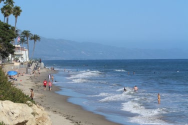
Santa Claus Lane Beach
As you follow the PCBR along Via Real towards Carpinteria, hang a right on Padaro Lane to access Santa Claus Lane Beach. This is a wonderful sandy beach with calm waves, great for swimming and sunbathing. The Padaro Beach Grill is also located here, which is a great spot to stop at and refuel before continuing your ride.
Linden Avenue / Carpinteria City Beach / Carpinteria State Beach
As you continue along the PCBR, the route will bring you into downtown Carpinteria. Taking a right on Linden Avenue off of the route will bring you into the heart of town. There are plenty of shops and restaurants along this stretch. At the base of Linden Avenue are Carpinteria City and State Beaches, which border each other and have a reputation as “the safest beaches in the world”. Hop in for a dip, then head back up Linden Avenue and continue on the PCBR.
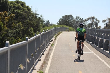
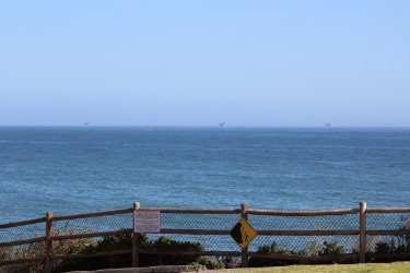
Rincon Point* and Mussel Shoals
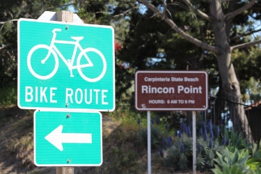
At the Santa Barbara and Ventura County line is the world-famous surf break Rincon, known as “The Queen of the Coast”. This is also the beginning of a portion of the PCBR that borders the pacific ocean on a dedicated bike path for nearly 6 miles. The views along this Santa Barbara bike path are unmatched in the area. The beginning of this portion of the route takes you directly past the base of Rincon Cove – if you’re here during the winter months, be sure to take a minute to admire the world-class waves and surfers.
*Please be aware that there is a brief section (a few hundred yards) of the PCBR that is on the freeway shoulder as you approach Rincon. The section travels along an onramp before quickly arriving at the Bates Road off-ramp for Rincon.
As you continue on the route, you’ll pass La Conchita, before arriving at Mussel Shoals. The long pier heads out to a man-made island known as Rincon Island, closed to the public. Mussel Shoals is also home to the Cliff House Inn and The Shoals Restaurant, which sits directly above the sand. The grass patio area just above the shore is an excellent place to stop for lunch during your ride.
Oil Piers Beach/PCH
The dedicated PCBR bike path ends at Oil Piers Beach (don’t look for the oil piers, they’re long gone!) and brings you to a seven-mile stretch of Pacific Coast Highway from Hobson Beach Park to Emma Wood State Beach. Faria Beach Park is also located along this stretch. There are wide bike lanes on either side of this seven-mile stretch that parallels the Pacific Ocean. At Emma Wood State Beach, the PCBR continues on a dedicated bike path that brings you to Surfer’s Point in the city of Ventura.